General geology
Type of resources
Topics
Keywords
Contact for the resource
Provided by
Years
Formats
Representation types
Update frequencies
Scale
-
Collections of Aerial Photographs purchased or obtained by BGS and its precursors as part of its surveying activities. Data covers mainly Great Britain or areas where BGS has worked overseas and dates from the 1940's. The collection is incomplete and there are copyright and other constraints on its use.
-
A 1:250,000 map showing the main geological bedrock divisions in Northern Ireland. The bedrock shown on GeoIndex map comprises the bedrock geology, which represents the outcrops (at surface) and subcrops (at near-surface, beneath superficial deposits) in Northern Ireland. For each rock unit there is a brief generalised description showing the major rock group, rock type and age under the following headings. LEX_D: The name of the selected area. This can be a group, formation or igneous intrusion e.g. dyke. LEX_RCS: Map code as it appears on the published 1:250,000 map. RCS_D: The name of the dominant types of rock (lithologies) in the different areas shown on the map e.g. granite. The names of the rock types given here are often generalisations, appropriate for the large areas of geological coverage at this scale. These areas may include a number of different geological formations whose distribution can only be portrayed on more detailed geological maps. RANK: Identifies formations and groups. Min_Time_D and Max_Tim_D: The age of the rock unit in terms of periods, relatively smaller units of geological time e.g. Carboniferous, Jurassic etc. Some of the map areas include rocks with a range of ages and these are shown as such e.g. Triassic to Cretaceous. The oldest metamorphic rocks are described as Moinian and Dalradian. The rocks range in age from those deposited relatively recently, some 2 million years ago, back to ancient and highly altered Precambrian rocks over 2500 million years old. In broad terms the youngest rocks are found in the south and east of the UK, the oldest in the north and west. VERSION: Version of the data. RELEASED: Date of release/update of the data. CAUTION Because of the generalisation and simplification used in the compilation of this map, it should not be used to determine the detailed geology of any specific sites. It is best used to provide a basic understanding of the geology of the country in general, and for showing the geology of large regions where broad trends are more important than specific details. Persons interested in the detailed geology of particular sites should consult the latest large-scale maps or the Geological Survey of Northern Ireland.
-
1:50,000 maps showing the main geological superficial divisions in Northern Ireland. This series shows the superficial (drift) geology of Northern Ireland at 1:50,000 scale. For each rock unit there is a brief generalised description under the following headings. LEX_D: Description of the selected polygon. LEX_RCS: Map code as it appears on the published 1:250,000 map. RCS_D: Decription of the deposit. VERSION: Version of the data. RELEASED: Date of release/update of the data. Persons interested in the detailed geology of particular sites should consult the latest large-scale maps or the Geological Survey of Northern Ireland at:- Geological Survey of Northern Ireland Colby House Stranmillis Court Belfast BT9 5BF
-
Index of onshore boreholes in England, Wales and Scotland for which BGS holds material either as registered specimens or cuttings. Developed to improve access by BGS staff and external enquirers to the major UK borehole collection.
-
Superficial Geology (250k) This layer shows the superficial (drift) geology of Northern Ireland at 1:250,000 scale. For each rock unit there is a brief generalised description under the following headings. LEX_D: Description of the selected polygon. LEX_RCS: Map code as it appears on the published 1:250,000 map. RCS_D: Decription of the deposit. VERSION: Version of the data. RELEASED: Date of release/update of the data. Persons interested in the detailed geology of particular sites should consult the latest large-scale maps or the Geological Survey of Northern Ireland at:- Geological Survey of Northern Ireland Colby House Stranmillis Court Belfast BT9 5BF
-
1:50,000 maps showing the main geological bedrock divisions in Northern Ireland. The bedrock shown on each map comprises the bedrock geology, which represents the outcrops (at surface) and subcrops (at near-surface, beneath superficial deposits) in Northern Ireland. For each rock unit there is a brief generalised description showing the major rock group, rock type and age under the following headings. LEX_D: The name of the selected area. This can be a group, formation or igneous intrusion e.g. dyke. LEX_RCS: Map code as it appears on the published 1:250,000 map. RCS_D: The name of the dominant types of rock (lithologies) in the different areas shown on the map e.g. granite. The names of the rock types given here are often generalisations, appropriate for the large areas of geological coverage at this scale. These areas may include a number of different geological formations whose distribution can only be portrayed on more detailed geological maps. RANK: Identifies formations and groups. Min_Time_D and Max_Tim_D: The age of the rock unit in terms of periods, relatively smaller units of geological time e.g. Carboniferous, Jurassic etc. Some of the map areas include rocks with a range of ages and these are shown as such e.g. Triassic to Cretaceous. The oldest metamorphic rocks are described as Moinian and Dalradian. The rocks range in age from those deposited relatively recently, some 2 million years ago, back to ancient and highly altered Precambrian rocks over 2500 million years old. In broad terms the youngest rocks are found in the south and east of the UK, the oldest in the north and west. VERSION: Version of the data. RELEASED: Date of release/update of the data. CAUTION Because of the generalisation and simplification used in the compilation of this map, it should not be used to determine the detailed geology of any specific sites. It is best used to provide a basic understanding of the geology of the country in general, and for showing the geology of large regions where broad trends are more important than specific details. Persons interested in the detailed geology of particular sites should consult the latest large-scale maps or the Geological Survey of Northern Ireland at:- Geological Survey of Northern Ireland Colby House Stranmillis Court Belfast BT9 5BF
-
The foreign sliced rock or 'F' collection consists of about 10, 000 specimens and thin sections, cited by their 'F' numbers. These include material archived from recent overseas projects and much collected during the late 19th or early 20th Century from regions within what was then the British Empire. It also includes 'exotic' materials donated to the Survey in its earlier years. Its coverage varies, although there is a predominance of African material. It is indexed on paper registers, and approximately 20% has been input onto 'Britrocks'.
-
Index to various collections of Aerial Photographs purchased or obtained by BGS and its precursors as part of its surveying activities. The index was set up in 2000 and mainly covers Great Britain. The level of spatial detail depends on the flight plans provided, but most are referenced at least to OS quarter sheet level.
-
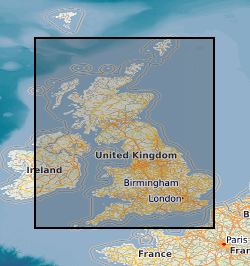
Collection of drillcore, bulk samples, unwashed cuttings and processed material from onshore boreholes drilled in the UK by BGS, commercial and public bodies. Developed as part of the BGS responsibility to establish and maintain a National Borehole collection. Details of the collection are held on the 'Borehole Materials Database', and may be accessed over the internet from the BGS internet site.
-
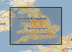
Collection of individually registered specimens and cuttings from onshore boreholes drilled in England and Wales by BGS, commercial and public bodies since the establishment of BGS in 1835. The collection has been developed as part of the BGS responsibility to establish and maintain a National Borehole Collection. The collection is updated on a daily basis by the addition of new data and by the modification of existing data. The collection contains all registered borehole samples for England and Wales, Scottish borehole samples are excluded. Details of the collection are held on the 'Borehole Materials Database', and may be accessed over the internet from the BGS web site.
 NERC Data Catalogue Service